Given the extensive flooding in our region and the proximity of our property to the Rideau River, I think it is natural for us to wonder: are we in any danger of flooding? Thankfully, the answer appears to be a no.
At our location, the Rideau River's water level is highly regulated, because of the proximity of Rideau Falls.
Looking at the flood risk assessments of the Rideau Valley Conservation Authority, performed in 2014 and in 2016, we find that at our location, there is virtually no "flood plain":
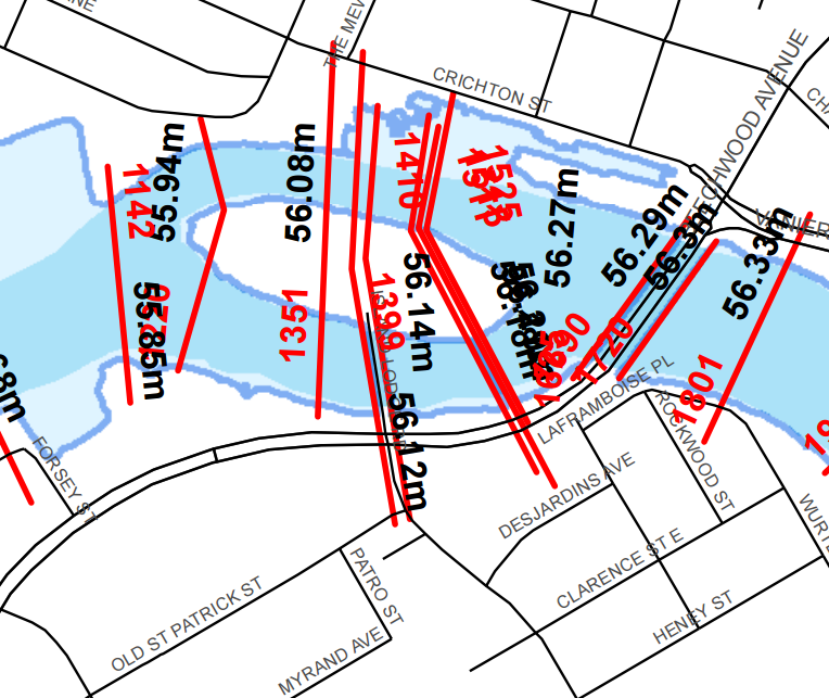
Note the 1399 cross sectional marking along the Porter Island Bridge. (I believe 1399 is the distance, in meters, from Rideau Falls.) Here is a detail of that cross section:
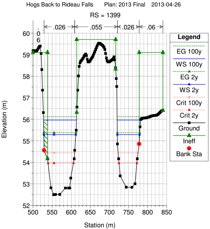
In this plot, WS is the abbreviation for Water Surface, whereas EG is the Energy Grade. The energy grade line is always above the water surface line unless the rate of flow is zero.
Anyhow, to make a long story short, if there is any flooding, it is on the other side of the river, in the park area; here on this side, we are probably safe.
That is, until something happens to the sewers... But hopefully, the city knows what they are doing on that front.